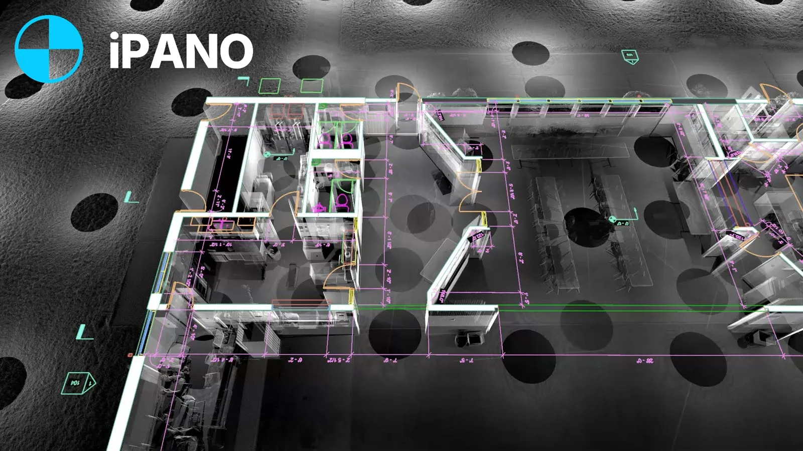
As-Built Drawings & Floor Plan Services
Measured drawings of your building as it exists today. iPANO laser-scans the site, then drafts accurate floor plans, elevations, and BOMA-compliant documentation your team can design against, delivered in DWG, RVT, IFC, and PDF on a timeline committed in your quote.
- Accurate as-built capture
- BOMA-compliant plans
- DWG / RVT / IFC / PDF
No obligation. Send your project details and we reply within one business day.
Request a quote
Tell us about the building. We respond within 24 hours with fixed pricing.
Takes 30 seconds. No spam, your details are never shared.
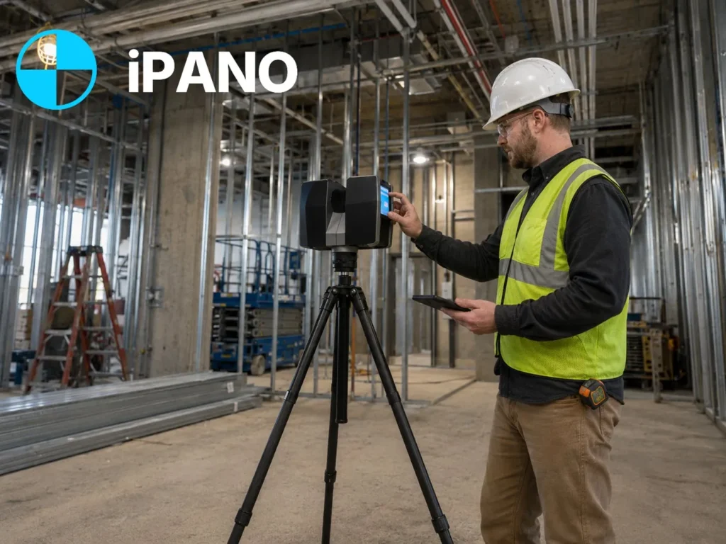
Drawings drafted from reality, not from old blueprints
Original construction drawings rarely match what stands on site. Walls move, systems get rerouted, additions never make it back onto paper. When architects, contractors, and property managers design against outdated plans, the errors surface later as change orders, rework, and blown schedules.
iPANO as-built services eliminate that risk. Our field technicians capture the building with survey-grade 3D laser scanners in a single visit, and our CAD technicians draft every drawing directly from the registered point cloud. Each dimension in the final drawing set traces back to measured scan data, checked through quality control before release, and backed by a quality check.
Compare that to the tape-and-laser-distance method. Manual measurement of a 20,000 square foot floor takes days, misses whatever the tape could not reach, and every transcription is a chance for error. A scan captures the same floor in hours, records everything in view, and the drawing team never has to interpret a hand sketch. When a dimension is questioned later, we pull it from the point cloud instead of sending someone back to site.
What your drawing set includes
Floor plans
Dimensioned plans for every level, drafted to your layer standards and ready for AutoCAD or Revit.
Elevations and sections
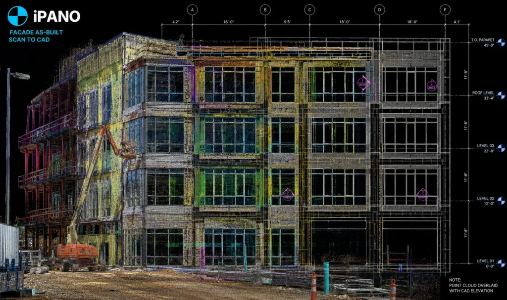
Interior and exterior elevations and building sections cut directly from the point cloud.
BOMA-compliant area documentation
Rentable and usable area calculations for leasing, prepared to BOMA standards.
CAD and BIM files
DWG for AutoCAD, RVT for Revit, IFC for open BIM workflows, plus PDF drawing sets.
What we document
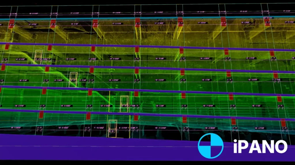
Elevations for renovation design
Facade and interior elevations with real measured geometry, so renovation drawings start from truth.
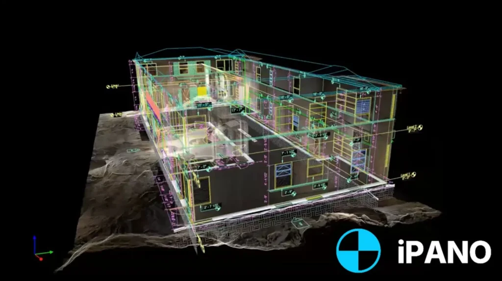
Scan-to-BIM Revit models
Intelligent 3D models built from scan data for coordination, quantity take-offs, and design.
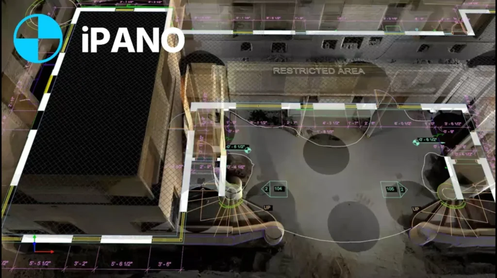
Site plans and exteriors
Site documentation combining aerial and terrestrial capture into one accurate plan.
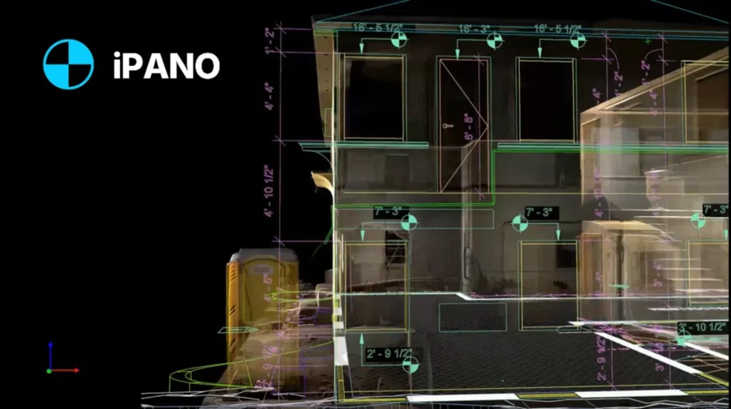
Residential as-builts
Fully dimensioned drawings for renovations, additions, and permit applications.
From scan to plan: recent deliverables
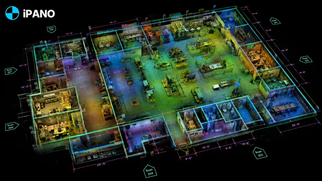
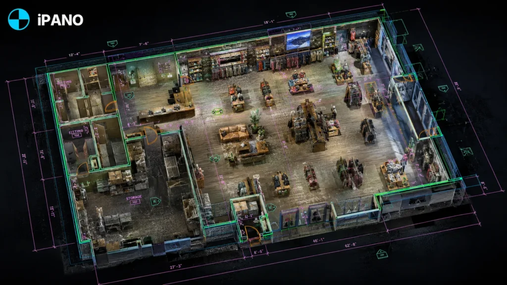

Where as-built drawings matter most
Commercial and retail
Landlords and tenants need BOMA-compliant plans for leasing, and designers need reliable base drawings before a fit-out. We document offices, retail units, and mixed-use buildings with the lease measurement standards built in.
Industrial and logistics
Plants and warehouses change constantly, and the drawings rarely keep up. Scan-based as-builts record racking, mezzanines, and services so renovation and equipment planning starts from current conditions.
Heritage and older buildings
Many older buildings have no usable drawings at all, and their walls are rarely straight. Laser scanning captures irregular geometry that tape measurement cannot, which makes it the standard for heritage documentation and conversions.
The equipment behind the drawings
Field capture runs on survey-grade terrestrial LiDAR scanners for accuracy-critical work, with handheld mobile mapping systems for large, open areas where speed matters more than millimeters. Drafting happens in AutoCAD and Revit against the registered point cloud, and every sheet is checked against the scan before delivery.
How a project runs
Tell us about the building
Send the address, approximate square footage, and the deliverables you need. We reply with fixed pricing within 24 hours.
We capture on site
Our field team documents the full building in a single visit. Non-intrusive, no shutdown required.
Production and QA
Our team produces your deliverables and checks them against the captured data before release.
Delivery on schedule
Files arrive in your formats, on a timeline committed in your quote and sized to the project.
Common questions
What are as-built drawings?
How accurate are the drawings?
Do you provide BOMA calculations?
What formats do I receive?
How long does it take?
As-Built Drawings & Floor Plan Services by city
- Toronto, Ontario
- Vancouver, British Columbia
- Calgary, Alberta
- Montreal, Quebec
- Ottawa, Ontario
- New York, New York
- Los Angeles, California
- Chicago, Illinois
- Houston, Texas
- Miami, Florida
- Ajax, Ontario
- Alliston, Ontario
- Aurora, Ontario
- Ayr, Ontario
- Barrie, Ontario
- Belleville, Ontario
- Bowmanville, Ontario
- Bradford, Ontario
- Brampton, Ontario
- Brantford, Ontario
- Brockville, Ontario
- Burlington, Ontario
- Cambridge, Ontario
- Chatham, Ontario
- Cobourg, Ontario
- Collingwood, Ontario
- Cornwall, Ontario
- Elmira, Ontario
- Fergus, Ontario
- Georgetown, Ontario
- Goderich, Ontario
- Guelph, Ontario
- Hamilton, Ontario
- Huntsville, Ontario
- Kingston, Ontario
- Kitchener, Ontario
- Lindsay, Ontario
- Listowel, Ontario
- London, Ontario
- Markham, Ontario
- Midland, Ontario
- Milton, Ontario
- Mississauga, Ontario
- New Hamburg, Ontario
- Newmarket, Ontario
- Niagara Falls, Ontario
- North Bay, Ontario
- Oakville, Ontario
- Orangeville, Ontario
- Orillia, Ontario
- Oshawa, Ontario
- Owen Sound, Ontario
- Peterborough, Ontario
- Pickering, Ontario
- Richmond Hill, Ontario
- Sarnia, Ontario
- Sault Ste. Marie, Ontario
- St. Catharines, Ontario
- St. Thomas, Ontario
- Stratford, Ontario
- Sudbury, Ontario
- Thunder Bay, Ontario
- Vaughan, Ontario
- Waterloo, Ontario
- Welland, Ontario
- Whitby, Ontario
- Windsor, Ontario
- Woodstock, Ontario
Get a fixed quote within 24 hours
Send your project details and receive transparent pricing and a clear scope for your drawings.
Request a quote